
We’d gone to Black Point Beach purely on a let’s-get-out-of-the-house whim. But when we got there and saw Dale McClure’s dump truck and big trailer, and then then discovered excavator tracks on the beach, we knew we’d stumbled onto an Event of Note — the tracks were the sign of a Tisbury Great Pond opening. We immediately went back to the truck and headed over to Tisbury Great Pond, to Quansoo.
Since the water level at Black Point was high, it was no surprise to see Quansoo flooded as well. Where we usually park in the summertime was awash.
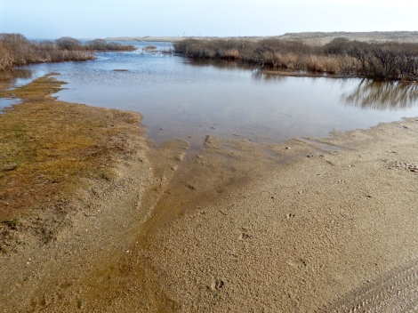
Quansoo parking lot. Awash.
As was the Crab Creek bridge.
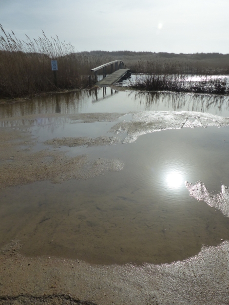
Crab Creek, awash. (Christine forgot her boots, and got a piggyback ride.)
While on the bridge we saw that water was flowing strongly from Black Point Pond towards Tisbury Great Pond. The current was confirmation that the Pond was open to the sea.
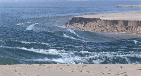
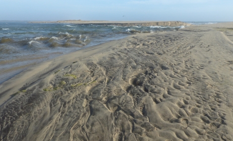
When we got to the beach, there were two sets of excavator tracks. Another confirmation.
We walked east, following the tracks.
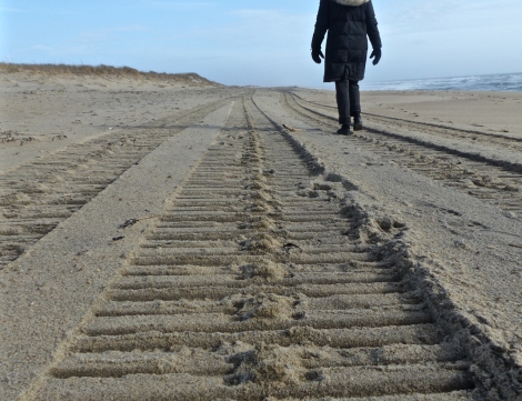
Following McCluretracks. With anticipation.
Yes.
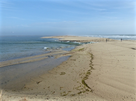
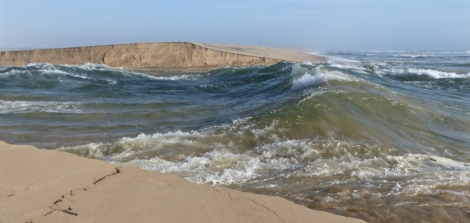
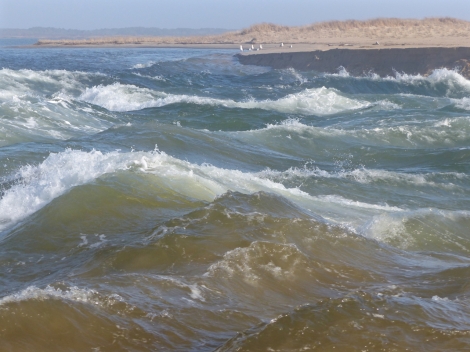
The Pond was open, flowing strongly out to sea.
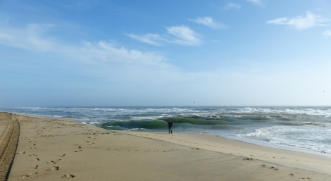
Tisbury Great Pond emptying into the Atlantic.
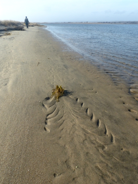
We estimated that Dale had finished breaching the beach an hour or so before our arrival. From the top of a nearby dune we could see a full Tisbury Great Pond emptying into the Atlantic. A “bathtub ring” of seaweed on the beach indicated that the pond level had already dropped by about a foot. Even at this distance, the rush of the water was impressive.
(I’ll add a note here: On March 27, 2017, the Edgartown Great Pond was opened. The work was videoed by drone. Follow this link to see the opening process: https://vimeo.com/210063812 )
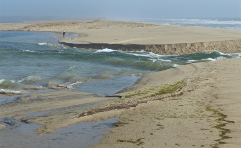
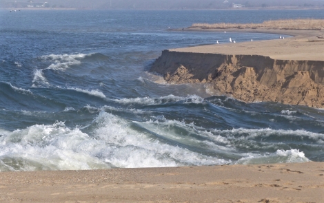
The peak height of the Pond is shown by the line of squiggly stranded seaweed.
Outrushing water digs deep…
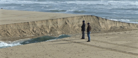
We saw our friend Felicity across the way.
Arnie and Ned had come down for the show.
Using them for scale, you can see how deeply the water has cut.
The current cuts, and cuts deeper.
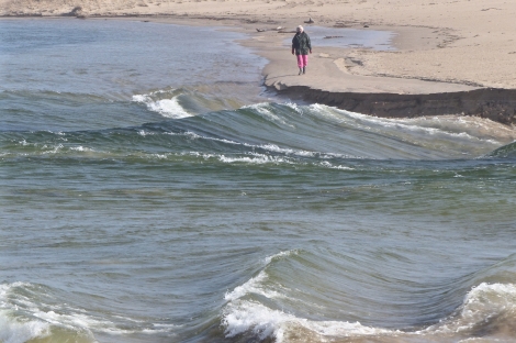
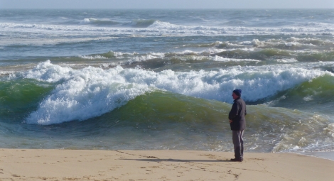
Here’s Ned at the edge…those waves are not surf, they’re standing waves in the outflow.
Their size changes from moment to moment, but these are between four and six feet high.
As the opening progresses, channels deepen.
And deepen.
Gulls stand by, waiting for opportunity.
Don’t get too near the edge. The water is powerful, potentially deadly. This Pond can drown, has drowned, and will drown you. I have known people who have lost their lives in this water.
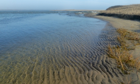
In the hours we were there, expanses of rippled sand were revealed.
Waves and current oscillations make the ripples, whose geological descriptive terms include the words straight, sinuous, catenary, linguoid and lunate.
The sand ripples are like the whorls, ridges, deltas, islands, bifurcations, and bridges in the skin of your hand and feet, fingers and toes.
They are like the ventral pleats of a whale’s chin.
So many patterns in nature are found again and again.
These lines echo, and re-echo the basic physical forces of the universe.
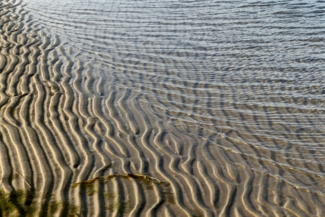
You could see these forms in the sands of Mars.
But we’re not going to Mars right now.
We’re going home.

Thank you for the journey. I haven’t seen the breach take place in several decades. I have a few ventral pleats in my neck as well; I didn’t know what they are called. This is a good one Tom.
Thank you, Eileen.
I enjoyed the feel of a potentially dangerous power
as the water flowed through your pictures….
nicely caught.
Love this. Like Eileen, I haven’t seen an opening in a long time. Can’t recall ever seeing Crab Creek that high either. Tread tracks in the sand are beautiful.
I can’t add a thing. I appreciate the opportunity to have learned through your photographs and thoughts, Tom.
I love this article and pictures. Susanne Langer in her writing, I think it is the book, Feeling and Form, or The Mind: an Essay in Human Feeling, talks about biological formations being paralleled in works of art in all mediums, and manifest in all biological realms. Wonderful post.
Comments like this are what make this blog feel worthwhile. Thank you very much. abebooks has the book for small money. I’ll try it.
Nov. 30, 2020
I’m thinking that engagement with an environment this dynamic would mitigate the loneliness many of us are feeling during the pandemic. It would certainly fill MY cup! Who needs people?
Quansoo has quintessences, one of which is constant change. Were you to go there every single day for a year, you’d see 365 different Quansoos. Holy smokes it can be cold there in deep winter.